Examples of environmental harm in Ukraine | return to map
Name: Karachunivske Reservoir dam
Location: Kryvyi Rih, Dnipropetrovsk Oblast
CEOBS database ID: 10914
Context
The Karachunivske Reservoir dam is situated to the west of Kryvyi Rih, a city in central Ukraine with a pre-war population of around 650,000. The reservoir has a capacity of 305 million m3 and since 1930 has supplied water to the city’s residents and its substantial metallurgical industry – including iron ore mines and Ukraine’s largest steel manufacturer PJSC ArcelorMittal.
Timeline of key incidents
14th September 2022
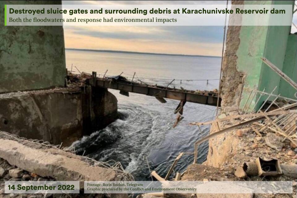
The dam was struck with cruise missiles, causing rapid and immediate discharge, as well as a water-level rise of 2.5 m in the River Inhulets. It has been suggested that the intention of the strike was to cut-off water supplies to residents and industry, induce flooding and disrupt military crossings of the River Inhulets as part of a counter-offensive strategy.
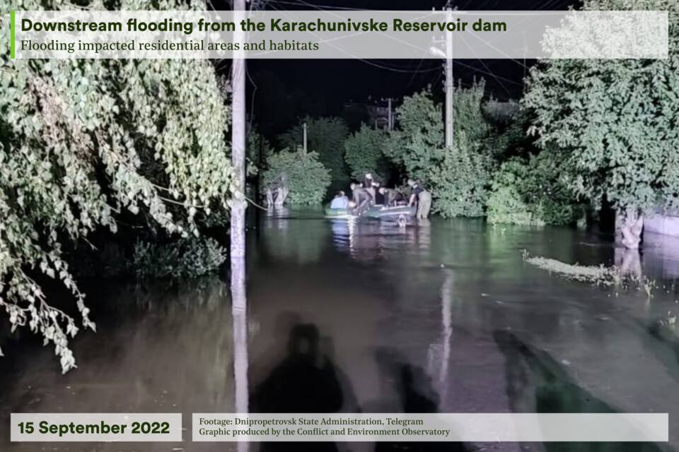
At the Mershavtesa Park in Kryvyi Rih’s central Tsentralno-Miskyi district, water levels increased by 1.9 m flooding nearby streets and properties, with approximately 112 homes affected and 11 residents requiring rescue. The next day, water supplies returned to the majority of districts and local settlements.
Damage assessment
In order to minimise the risks from flooding, controlled detonations were carried out on the Chornohorka dam around 10 km downstream. This led to a 40 cm drop in water levels, and no flooding was reported in Kherson Oblast downstream; as a result, the impacts were relatively contained. Overall, there was an estimated total discharge of 16.9 million m3.
Environmental harm assessment
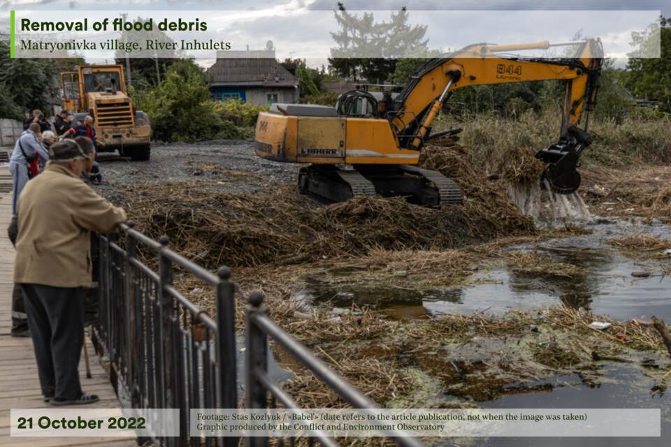
The destruction of the sluice gates and resulting reservoir discharge led to measured increases in phosphates and nitrites in the River Inhulets downstream. This is likely to be due to the flooding of household sanitation, waste and utility systems, with the formation of ‘garbage islands’ reported by the local community. Furthermore, the construction debris from the explosion and the large volumes of water washed away trees and impacted habitats from the edges of the river. Although there were increased levels of suspended material in the water, the dissolved oxygen content remained above 90% – enough for the survival of the river flora and fauna.
The reservoir dam sits at the interface between two important components of Ukraine’s Emerald Network of ecologically important areas:1 the reservoir (Kryvorizka, part of the River Inhulets) and the Inhulets channel (Middle Inhulets River Valley). These two sites, which should enjoy increased protection for threatened species, form part of a recently protected area of grasslands. A third proposed site, the Saksahan River Basin, lies partly adjacent and is a tributary to the River Inhulets.2
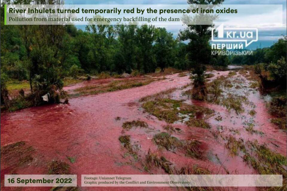
After the incident, the dam was reinforced with loam and crushed stone with high concentration of haematite, or iron ore – causing the river to turn red. A water sample taken downstream of the dam revealed maximum permissible concentrations for ammonium nitrogen were exceeded by 2.5 times and iron by 3 times. Although alarming to see, local environmental groups insisted that people should ‘not panic’; the effect was short-lived and posed no immediate danger to health. To prevent further discolouration of the river, quartz and crystalline slates were used instead of haematite. Raised levels of ammonium nitrate increases the risk of algal blooms and consequent eutrophication, which may lower oxygen levels in the medium term.
Mining effluents containing high levels of mineralisation and heavy metal content (Cu Fe, Mn, Cr and Pb) are regularly released into the Inhulets. The high-intensity flows from the dam may have led to the remobilisation of these pollutants from contaminated river sediments.
Longer-term implications
The River Inhulets passes a series of open-pit iron ore quarries downstream of the dam. The tailings for the mines in the south of the city are stored in the Svistunov storage pond and the sulphate-chloride-calcium mine water accumulates over the April to October growing season. When released during the winter to minimise ecological and agricultural impacts, the supply of relatively fresh water from the reservoir is sufficient to dilute the mineralised tailings. It is possible that the damage to the dam will impact this management system, increasing the pollution risks from mining waste in the River Inhulets.
External resources
Kryvyi Rih ad hoc flood risk assessment | ReliefWeb
Return to the country map here.
- The Emerald Network is an ecological network made up of Areas of Special Conservation Interest. It was launched by the Council of Europe as part of its work under the Bern Convention (the Convention on the Conservation of European Wildlife and Natural Habitats).
- Kryvorizka part of Inhulets river (SiteCode: UA0000319), Area: 22,472.86 ha; Middle Inhulets river valley (SiteCode: UA0000310), Area: 15,204.94 ha; Saksahan river basin (SiteCode: UA0000406), Area: 20,726.69 ha

