Examples of environmental harm in Ukraine | return to map
Name: Lysychansk Oil Refinery
Location: Lysychansk, Luhansk Oblast
CEOBS database ID: 10168
Context
Lysychansk Oil Refinery is Ukraine’s second largest, and covers around 800 hectares; it is also one of its most modern, having been completed in 1976. Production peaked in 1991 (23.7 Mt), but had declined by 2010 (4.8 Mt), and in 2012 unprofitability caused operations to cease. The facility suffered conflict-linked damage in 2014 due to its proximity to the frontline. Conflict and its Russian ownership have made the upgrades and repairs needed to reopen the facility impossible. The frontline came to the site during the battle for Lysychansk, the last city in Luhansk to fall under occupation in 2022.
Timeline of key incidents
22nd March – 8th May 2022
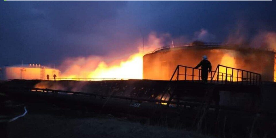
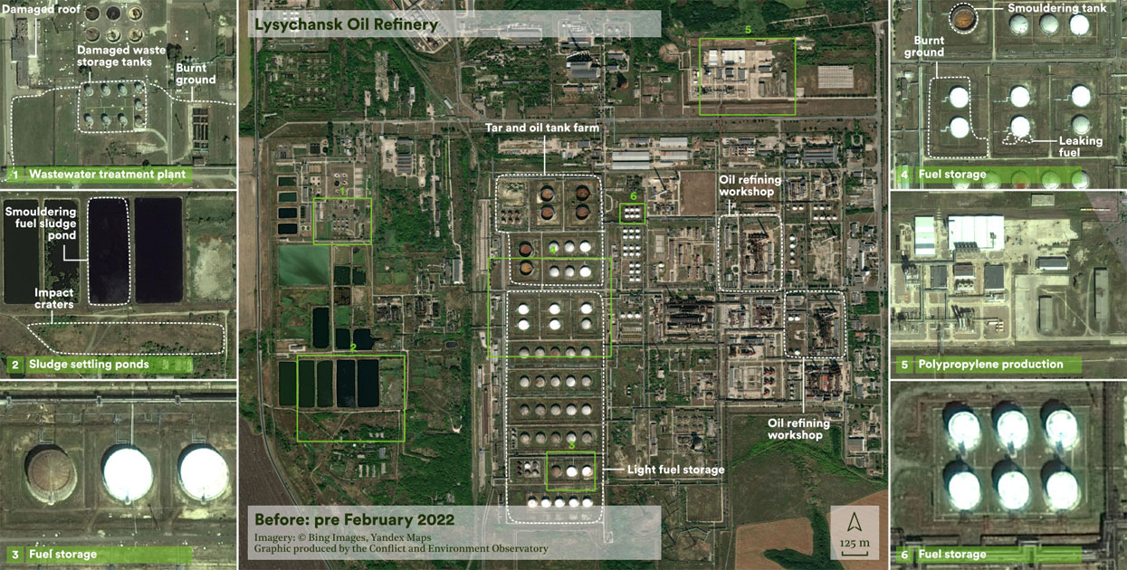
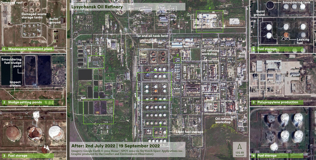
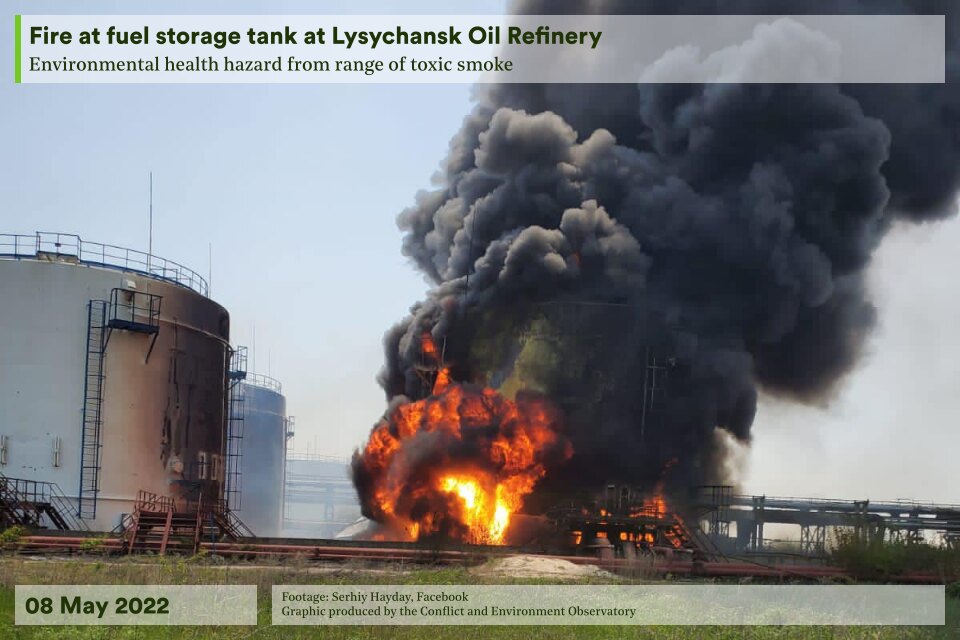
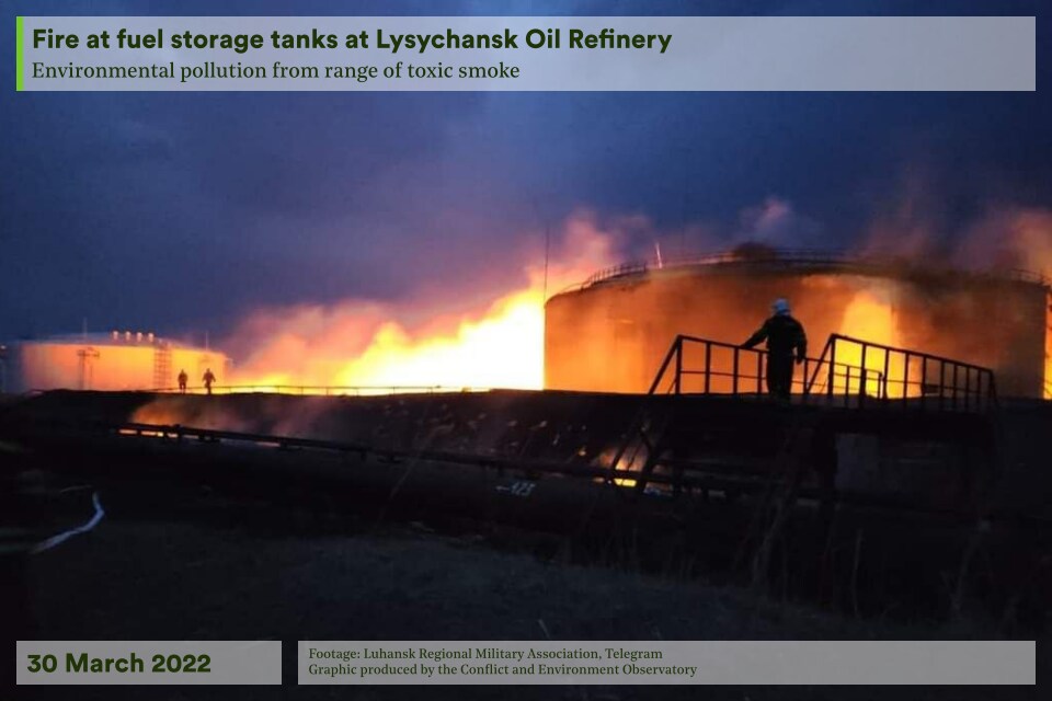
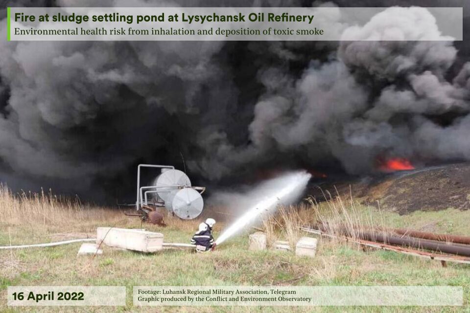
As frontlines moved towards Lysychansk and Sievierodonetsk, sporadic shelling caused a number of environmentally harmful incidents. In particular, strikes on the 22nd and 31st of March left oil tanks containing light petroleum either partially or completely destroyed; social media footage and satellite imagery showed the tanks on fire. On the 16th of April a significant fire of around 5,000 m2 burned at two water treatment ponds that contained oil sludge. On the 8th of May numerous fires spread across the facility, including at a sulphur extraction plant, the substance mixing station and at other tanks. Satellite imagery from the following day showed smoke plumes still stretching more than 4 km from the site.
26th June – 1st July 2022
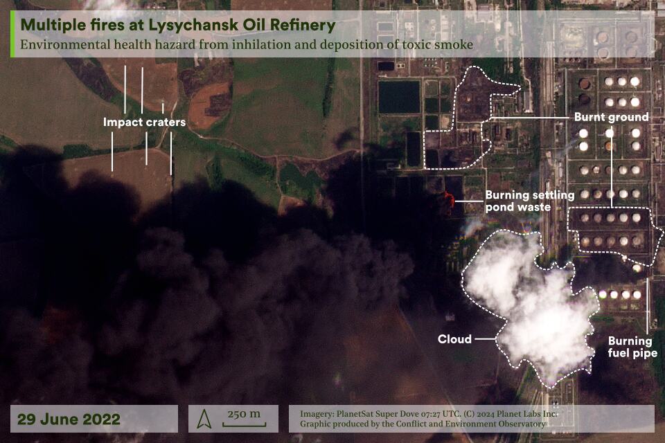
The battle for Lysychansk ended with the occupation of the city and the refinery. Military forces reportedly occupied the north eastern and south western sections of the refinery by the 30th of June, and satellite data details extensive facility-wide damage during the fighting. Smoke plumes were visible rising from various workshops and pipelines surrounding its storage tanks, while large fires engulfed the same settling ponds that had burned earlier in the year.
Damage assessment
The scale of damage to the site is visible in drone footage, and in satellite imagery. This includes the destruction of multiple workshops and the former hydrogen production and catalytic cracking units. Analysis of satellite radar damage maps and building footprints suggests that at least 38% of built structures at the refinery have been damaged.1 Imagery also reveals that tens of square kilometres of land within and outside of the site are densely cratered due to the high volume of shelling.
Environmental harm assessment
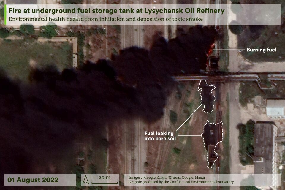
Since February 2022, the largest and likely most damaging fires appear to have occurred on the 16th of April and 29th of June at the settling ponds, which contain by-product oil sludge.2 Oil sludge can contain toxic substances, including benzenes and phenols, which are carcinogens. As such it is categorised as hazardous and refineries are required to manage it appropriately. The combustion products of such sludges are poorly characterised.3
The smoke from these fires and those throughout the facility will have contained very high concentrations of particulate matter, NOx, nitrous acid, carbon monoxide, sulphur dioxide, VOCs such as formaldehyde, and potentially dioxins, furans, hydrocarbons and PAHs. Those still remaining in nearby settlements were exposed to these pollutants.4 Visually, many of the plumes were very dark, meaning the particulate matter is likely to have included a high proportion of black carbon – a pollutant of relevance for public health and the climate.
The refinery was a contaminated site long before the 2022 invasion.5 Understanding this baseline is important for any assessments of conflict-linked environmental harm. Such an approach has already been taken: during the brief occupation in 2014, tanks with residual oil were set alight and a 2017 study found small increases in vanadium, strontium and lead in the soil.
Longer-term implications
As of April 2024, The facility remains in an occupied area and close to the conflict frontline, reducing the likelihood of assessments or remedial work being undertaken and increasing the risks that pollution on and around the site will worsen. Offsite transport of pollutants can occur as a result of contaminated water and soils, as well as deposition from the plumes from fires. As well as contaminated soils, the attacks have also led to large volumes of waste and debris, some of which may contain hazardous materials such as asbestos. When they are eventually undertaken, remedial measures at the site will generate significant waste streams that will need to be appropriately managed to prevent further harm.
External resources
Risks and Impacts from Attacks on Fossil Fuel Facilities in Ukraine | PAX
Environmental assessment and recovery priorities for Eastern Ukraine | OSCE
Return to the country map here.
- This was calculated by analysing the intersection between built structure polygons, obtained from a combination of OpenStreetMap and Microsoft Buildings, and damage mapping produced by Jamon Van Den Hoek (Oregon State University) and Corey Scher (City University of New York), derived from Sentinel-1 data. Visual inspection of very high resolution satellite imagery shows that this method underestimates damage.
- An immediate emergency services response was documented during the earlier of these fires, while in the latter case active fighting meant a response was not possible, meaning that fires burned for longer and that impacts were likely larger.
- While the risks posed by degrading petroleum compounds to the environment are well understood, research into the environmental impacts of burning oil sludge is more limited. Without assessment of the composition of the oil sludge or the plumes they created, it is impossible to fully assess the precise harm caused.
- Although cloud obscured satellite observations of the fire on the 26th April, imagery shows that the largest plumes from fires on the 29th June travelled in a south westerly direction, visibly stretching over 20 km, and close to a cluster of settlements including Bakhmut, Soledar and Kostiantynivka. Many of these were evacuated or destroyed by June 2022, but inhaling the smoke would pose health risks to any inhabitants who remained.
- A long-term study in 2019 found ‘moderately dangerous’ concentrations of pollution. The authors also calculated that between 2000 to 2005 the facility released an estimated 18 million tonnes of pollutants into the air annually, including CO, SO2, CH4, NO2 and PM. Between 2016 and 2019, this had reduced to 66,670 tonnes per year. However, pollution from normal operations since 1979 are probably more important – these contaminants will likely have chemically transformed or migrated in the environment. This is especially true for the period since 2012 due to poor governance at this time; for example it is unclear if recommended priority work on modernising the wastewater treatment facilities took place.

