Does the extent of the Sudd wetland influence conflict frequency?
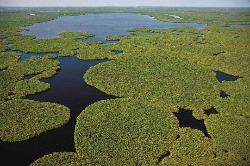
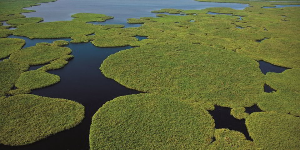
The Sudd wetlands. Image credit: UNEP, Flikr
In this article Charlotta Ruuskanen, a recent MSc graduate from the University of Lund, summarises work from her thesis, which investigated the hypothesised link between local pastoralist-herder conflicts and the dynamics of the Sudd wetlands, South Sudan. The annual size of this richly biodiverse area is primarily influenced by climate, and so insights into the nature of the conflict may help inform about future risks, and more broadly, the relationship between climate and security. In an accompanying report we detail further threats to the Sudd wetlands.
Pastoralist conflict in the Sudd
The Sudd wetland is situated alongside the White Nile in South Sudan. At approximately 57,000 km2 it is one of the largest freshwater ecosystems in the world and supports various endangered mammalian species, palearctic migratory birds, and large fish populations. The abundance of wildlife within the wetlands has resulted in the creation of numerous nature reserves in efforts to protect and conserve the unique habitats, and in 2017 the wetlands joined the list of tentative UNESCO World Heritage Sites.
The Sudd provides important ecosystem services, including water purification, flood control, carbon sequestration, fish and wildlife habitats, and year-round grazing grounds for livestock owned by the indigenous pastoralist cultures inhabiting the surrounding area.
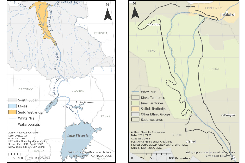
Figure 1 (left): The rivers included in the White Nile; Victoria Nile, Albert Nile, Bahr el Jebel, Bahr el Zeraf and El Bahr el Abyad. Originating from Lake Victoria and passing through Lake Kyoga and Lake Albert before reaching the Sudd wetlands in South Sudan.
Figure 2 (right): The territory boundaries of the three main indigenous pastoral groups inhabiting the protected areas of the Sudd wetlands including the Dinka (brown), Nuer (green), and Shilluk (orange).
The wetlands support pastoral communities including the indigenous Dinka, Nuer and Shilluk, along with other tribes, including the Anyuak, Misseriya, and Murle. For these pastoral cultures, livestock plays a central part in everyday life, usually serving as a key function in economic and social systems. The livestock sector is fundamental to South Sudan, valued at $3 billion and comprising about 25% of GDP. Livestock practices of pastoral communities are entirely dependent on the wetland for providing enough palatable grazing grounds to sustain the cattle herds. During the drier months, pastoral communities migrate with their livestock towards the Sudd in a seasonal search for grazing and water, when much of the surrounding Sudano-Sahel region remains dry and largely resource depleted.
One of the primary forms of conflict within grazing territories is through cattle raiding, a longstanding historical feature of many pastoralist societies. More recently, and thanks to long-lasting armed conflict, the widespread proliferation of arms has led to more violent raiding practices. Research indicates that the competition over natural resources might be a potential cause of conflicts in regions dominated by pastoral cultures. Violent competition between and among pastoral groups has been previously documented because of intense pressure from climate-induced stressors.

Figure 3. The distribution and density of armed conflicts associated with pastoralist communities surrounding the wetland area during the dry season (December-March) between 2000-2020. Conflict data obtained from ACLED.
To better understand the nature of pastoralist conflict, data from between 2000 and 2020 from the Armed Conflict Location and Event Data Project (ACLED) was examined as part of this project. To hone down on pastoralist conflict, the dataset was filtered to include only:
- Events within a 30 km radius of the protected areas.
- Disputes associated with herder and pastoralist societies, by using keywords to filter the ACLED dataset. 1
- The drier months of December to March, when pastoralists return to the previously flooded grasslands.
In total, 42 conflict incidents and 260 fatalities were identified through this filtering. The majority of incidents involve cattle raiding and are described in a matter-of-fact manner, as can be seen in the carousel of selected incidents. This made it impossible to draw any conclusions on environmental causes from the incident descriptions alone.
On 20 and 21 April 2020, attackers from Panyijar county (presumed to be Nyong Nuer) attacked a cattle camp at an unspecified location in Dok Nuer-inhabited Mayendit county (Unity state), leading to two days of fighting which resulted in 7 deaths and 4 wounded (fatalities spread across two events). 20,000 head of cattle were reported to have been stolen during the fighting.
Armed Murle cattle raiders launched three consecutive raids against the villages of Nyan-ngic, Pieri and Tiam, leaving 30 people dead, wounding many more and stealing 5,600 heads of cattle.
On 4 December 2020, attackers from Panyijar county (presumed to be Ador Nuer) attacked and torched the villages of Ameth Ciek, Mayom, Ayiem and Mayen in Adior payam in Yirol East county (Lakes state), killing at least four (including a former SPLM county secretary) and wounding two, and raiding 29 head of cattle. Around 3110 people were displaced in the attacks (which may have extended over the weekend).
Close to 80,000 heads of cattle are raided from Pajut cattle camp in an attack not far from the border between Bor-Twice East counties in which two people are killed.
Clashes between suspected Murle militiamen who had come to raid a cattle camp and local youth in Jalle payam, Bor county. A total of 28 people were killed, including 11 of the attackers and 17 from Jalle.. The militiamen stole over 12,000 heads of cattle from the residents.
The geographical distribution of pastoralist conflicts during the dry season is illustrated in Figure 3. There is a higher density of conflict incidents in the larger settlements and near to ethnic borders. Figure 4 shows the frequency of the conflict incidents since 2000, which reveals an approximate doubling of incidents from 2013 onwards – this is coincident with the start of the South Sudanese civil war along ethnic borders in December 2013.

Figure 4. The number of reported conflicts (Y1-axis) and fatalities (Y2-axis) associated with pastoralist communities surrounding the protected areas of the wetland (30km radius) during the dry season (December-March) between 2000-2020.
Climate security
Over the past decade there has been much research into climate security in the Sudano-Sahel. Is this hyperbolic or might the climate be driving the change in conflict intensity observed in the Sudd? And if so, how might levels of conflict respond to future changes in the climate?
The key climatic driver of conflict is likely to be through the modulation of the extent of the Sudd – which is dependent on river levels, and the complex interaction between soil vegetation, topography and seasonal trends in rainfall and evapotranspiration. The wetlands are formed by the White Nile in a flat topographic area between the towns of Bor and Malakal, and sustained by an inflow of water originating from Lake Victoria.
The extent of the Sudd wetland is highly variable, ranging between 42,000 km2 during the dry season to 90,000 km2 in the rainy season. The variability of the wetland extent is dependent on fluctuations of river discharge, in addition to local rainfall runoff. The annual movement of the Inter-Tropical Convergence Zone brings on the rainy season, usually extending from late April to November with a seasonal peak in July/August. The rainfall is however variable in both time and place, and average annual precipitation observations around the wetland vary between 1000 mm/yr in the southwest to 600 mm/yr in the northeast.

Figure 5. Lake Albert Levels in meters above surface reference during the previous wet season (blue) and seasonally-flooded grassland (SFG) area of March month within the study area in km2 (grey) during 2000-2020.
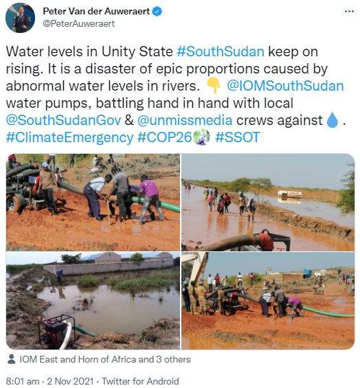
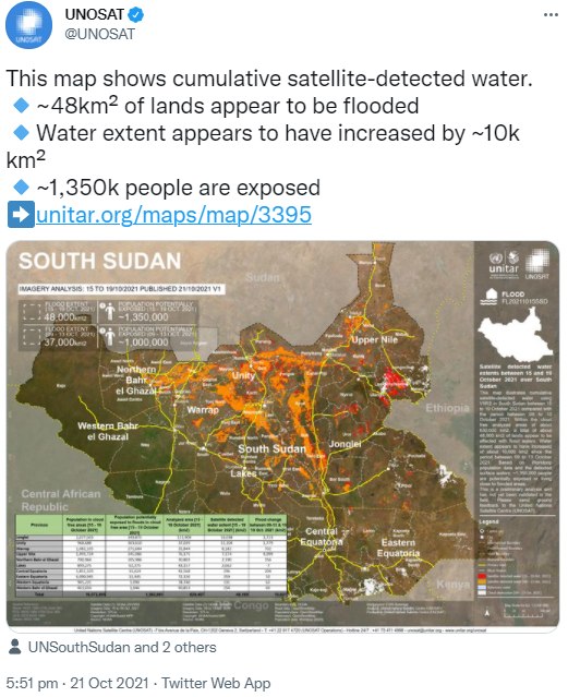
What’s more, the climate of South Sudan and the Nile basin is changing. There is now increased year-to-year variability in precipitation, swinging from 50% higher to 50% lower than average rainfall conditions between any two years, with the rainy season start and end dates shifting, and its duration shortening. Over the past three years South Sudan and the Sudd have seen massive and unprecedented flooding, causing huge destruction and suffering. So far this year, three quarters of a million people have been affected and displaced by flooding, with no respite in sight – the rainy season is expected to last longer than usual, to February next year.
Whether the recent flooding is attributable to climate change remains to be confirmed, but it has resulted in significant displacement of pastoralists. The floods have forced the Dinka tribe to migrate to the Equatoria region – armed and without asking permissions, this has caused conflict with the host communities, and government interventions forcing cattle camps to return to their original areas. The floods have also resulted in livestock losses, compounding or initiating rivalries and tribal conflicts.
Future precipitation projections for the Sudd and the upstream Nile basin are not consistent, with significant variability geographically, temporally, and between climate models. However, a recent downscaling and averaging of 20 of the latest-generation climate models indicates annual precipitation increasing over the Sudd, but with overall decreases upstream.
There is more agreement on annual temperature increases – they will increase by at least 1.5°C by mid-century. This leaves open the prospect of increased evapotranspiration, which may shrink the Sudd, with perennial rivers becoming seasonal. Clearly, this would have a significant impact on access to water and fertile grazing for pastoralists. However, evaporation from wetlands is complex, site-specific and temporally-variable, and more research is required.
Are pastoralist conflicts and wetland dynamics linked?
The question studied here was: to what extent are these local conflict incidents prompted by the dynamics of the Sudd wetland (i.e. climate)? In wet years, when the areas of floodwater are larger and more persistent, and the area of grassland smaller, it is hypothesised that there is more conflict between pastoralists. If this is the case, then it may open routes for targeted environmental peacebuilding initiatives in wetter years, whether these are the result of climate change or upstream management.

Figure 6. The NDVI and wetland cover classes; open water (OW), seasonally-flooded grassland (SFG) and marsh (M), within the study area in March 2010 and March 2014. NDVI data obtained using MOD13Q1.006 250m from LP DAAC.
The political instabilities within South Sudan makes obtaining in-situ data measurements difficult. Earth observations, via satellite remote sensing, provide a solution to monitor areas otherwise restricted by inaccessibility or regional conflicts. This study used the Normalised Difference Vegetation Index (NDVI),2 as measured by the MODIS instrument onboard the Aqua and Terra satellites, to monitor wetland vegetation changes within the protected areas of the Sudd during the end of the dry season. For each year, each pixel within the wetland area was then classified into open water, marsh, or seasonally flooded grassland, based on the NDVI value – as exhibited in Figure 6.
The temporal and spatial correlations between this wetland cover classification and ACLED conflict data were then explored, building on a similar approach in an earlier study. This work extends the period covered from 2000-2014 to 2000-2020.

Figure 7. The mean and standard deviation NDVI of March month within the protected areas of the Sudd wetlands during 2000-2020. Pixel (250m x 250m) count for each yearly image is 533966. NDVI data obtained using MOD13Q1.006 250m from LP DAAC.
No significant correlations were found between the land cover classification and annual dry-season conflict frequency or fatalities. This indicates there is only a very limited direct relationship between wetland extent (hence climate) and pastoralist conflict in the Sudd. There may still be a relationship, just a more indirect one, or a co-variable with another driver, and hence not picked up by simple correlations.
There was, however, a statistically significant positive correlation between conflict frequency and the mean NDVI of the Sudd.3 This indicates that in years where biomass is greener, because of better growing conditions, and pasture presumably more nutritious, there has been more conflict.
These findings are somewhat contradictory to previous research, which has proposed that the potential drivers of conflicts in regions dominated by pastoralist cultures are the scarcity of natural resources. So how robust are they, especially given the potentially complex and multi-faceted nature of the ongoing conflicts? Well, the findings remain tentative, as there are issues with both datasets used, which illuminate issues with these types of analyses in the climate security literature.
The ACLED data is unfortunately imperfect in two ways. Firstly, the dataset relies on media reports, which vary in frequency over time, with smaller or more rural events less likely to be reported on. The varying level of descriptions of the events over time also means we cannot be sure our filtering captures all relevant incidents. The scale of the under-counting is difficult to quantify, hence one cannot be sure that the true temporal trend is captured in Figure 4. Further, even if a detailed location is known, the ACLED database geo-codes events to the nearest town or city, biasing geographic analysis as in Figure 3. Any future study would thus be improved by better conflict data – ideally based on a large number of surveys and interviews with pastoralists themselves, to understand if they see climate as one the primary drivers of conflict.
For the satellite data, ground data is needed to validate the land classifications, and ensure they are representative and relevant for a study that uses them to assess potential available grazing extent. Furthermore, analysing wetland vegetation dynamics beyond the borders of the protected areas may reveal different conflict-wetland relationships.
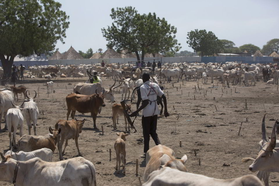
Figure 8. Armed cattle herders in South Sudan. Image credit: UNMISS, Flickr.
Causes of pastoralist conflict
If the results of this study suggest climate is not a primary driver of the pastoralist conflicts, then what is? The findings of this work are consistent with recent reports by Search for Common Ground, the Clingendael Institute, the GSDRC, and Climate Links, which broadly agree that pastoralist conflict is more linked to broader economic and political conditions, with climate playing a more minor role in increasing and aggravating conflict risk.
The step-change in conflict incidents since 2013 in Figure 4 suggests the fallout from the ongoing South Sudanese civil war may have had a more significant impact. Indeed, the conflict had a significant impact on the livestock sector. It resulted in a redistribution of livestock to political and military elites, who used conflict resources to acquire massive herds through commercial and politically motivated cattle raiding.
This represents a longer term trend of cattle raiding becoming more professionalised and using heavy weaponry, with militia groups of ‘cattle guards’ such as the Nuer White Army and the Dinka Titweng offering ‘protection’ but in so doing, exacerbating intercommunal conflicts. The post-2013 shift is described by the Clingendael Institute as ‘a big part of the resource game underpinning national politics’, key to affecting the power dynamics, and has led to an erosion of traditional norms – such as the collapse in the effectiveness of traditional compensation mechanisms such as cattle payments.
Pastoralists are now entangled in a widening web of violence, more associated with political or tribal disputes than any environmental considerations – indeed, security concerns are more likely to make pastoralists take the safer route rather than the one with the best natural resources. So, although climate change may aggravate and exacerbate violent conflicts, it will likely remain a secondary driver to tensions arising from the failure of equitable resource governance.
Conclusions
In this study the relationship between the extent of the Sudd wetland and conflict was interrogated to test the hypothesis that in wetter years there is more fighting. It was found that there was no evidence of this relationship, fitting in with a broader scope of work on livestock conflicts in South Sudan, which shows that climate only plays a minor role, secondary to the changing political landscape. This is also consistent with the emergence of a wider picture on climate-security, that climate changes are not as directly linked to fighting as conceptually imagined.
Currently in South Sudan, tensions remain high following clashes during the summer which risked the fragile peace deal of February 2020, underlining the insecurity that reigns. It is also one of the most food-insecure countries in the world, with over half the country facing acute food insecurity and the threat of all-out famine – which is likely already occurring in some regions. This conflict and insecurity feeds into the larger questions of the future of the Sudd, which we investigate in an accompanying article.
Charlotta Ruuskanen has an MSc from Lund University in Physical Geography and Ecosystem Science and now works on wetland hydrology at the Swedish Meteorological and Hydrological Institute. Eoghan Darbyshire is CEOBS’ Researcher and helped in supervision of Charlotta’s thesis and the preparation of this article.
- The ACLED dataset contains records of additional important details surrounding the events. The notes are kept short to only report on significant details about the specific event. The keywords used to filter the ACLED dataset included cattle, cow, raid, pastoralist, and herder.
- The NDVI provides a quantitative indicator of plant health and is calculated by taking the difference between satellite measurements in the near-infrared, where vegetation strongly reflects, and red light, which vegetation absorbs.
- The correlation between the mean NDVI for March and the pastoralist dry-season conflict frequency, over the period 2000-2020 for the area of the Sudd wetland had a Kendall’s Rank Correlation Tau of 0.45, and p-value of 0.01.

