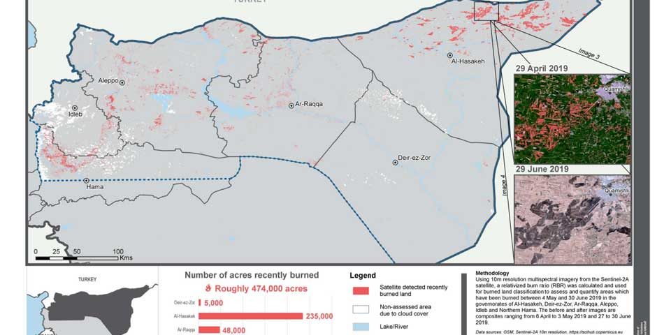
Satellite analysis reveals extent of damage from 2019’s spate of agricultural fires

Analysis of Sentinel-2A data by the REACH Initiative has revealed the extent of damage to agricultural areas in Syria from wildfires between May and June. The study found that 948,000 acres of land had been affected by fires, many of which were believed to have been started deliberately or were the result of military activities. The findings have implication for food security and livelihoods.


