Anyone with an internet connection can now contribute to the first step of our remote environmental assessment process.
Rebekah Harries introduces WISEN WATCH: our new citizen science tool that allows anyone to help us remotely track and assess wartime environmental damage.
Participatory conflict monitoring
Advances in satellite imagery and open-source research methods are transforming how environmental harm during armed conflicts can be documented. At CEOBS, these developments have shaped the creation of the Wartime IncidentS to ENvironment Database (WISEN): a framework for identifying, assessing, and documenting environmental harm linked to armed conflicts. Today, we’re expanding that work through public participation.
Following the launch of WISEN, we’re introducing WISEN WATCH: a new assessment tool hosted on the Zooniverse citizen science platform. Through WISEN WATCH, volunteers can help identify visible damage using satellite imagery, contributing directly to CEOBS’s conflict monitoring database.
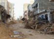
Our first WISEN WATCH projects focus on Iran and Lebanon, assessing damage linked to the regional conflict from the onset of the Iran War on 28th February 2026 through to the 8th April 2026 ceasefire agreement.
Why citizen science matters
Our monitoring of environmental harm during armed conflicts has depended on a small team of researchers manually reviewing satellite imagery and open-source information. While effective, this approach is labour intensive and difficult to scale across multiple conflicts and large geographic areas.
WISEN WATCH explores how citizen science can help decentralise and expand this work. By opening part of the verification process to volunteers, the project aims to make conflict environmental monitoring more scalable, transparent, and accessible, while also building broader awareness of the environmental dimensions of war.
How WISEN WATCH works
WISEN WATCH focuses on what we call “Level 0” assessments within the wider WISEN framework. At this stage, the goal is straightforward, to determine whether there is visible damage to environmentally relevant facilities, such as oil terminals or chemical factories.
The system builds on open source data produced by the Conflict Ecology geospatial research lab at Oregon State University. Their methods use Sentinel-1 radar imagery and interferometric synthetic aperture radar (InSAR) coherent change detection techniques to identify locations where buildings or infrastructure may have been damaged or destroyed.
Radar-based analysis is well-suited to damage detection because it can flag areas where previously stable structural signatures break down in ways consistent with building damage or destruction, even under cloud, smoke, or low-visibility conditions. The automated analysis highlights areas where significant structural changes may have occurred.
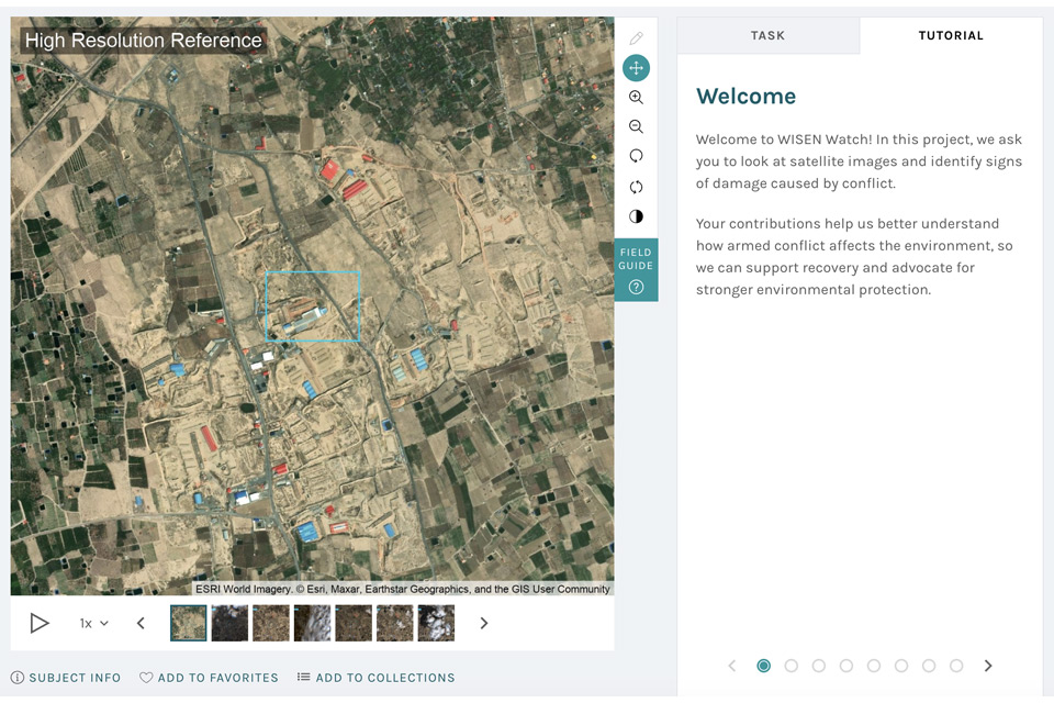
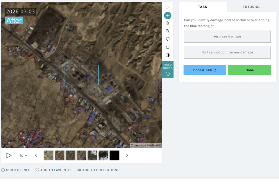

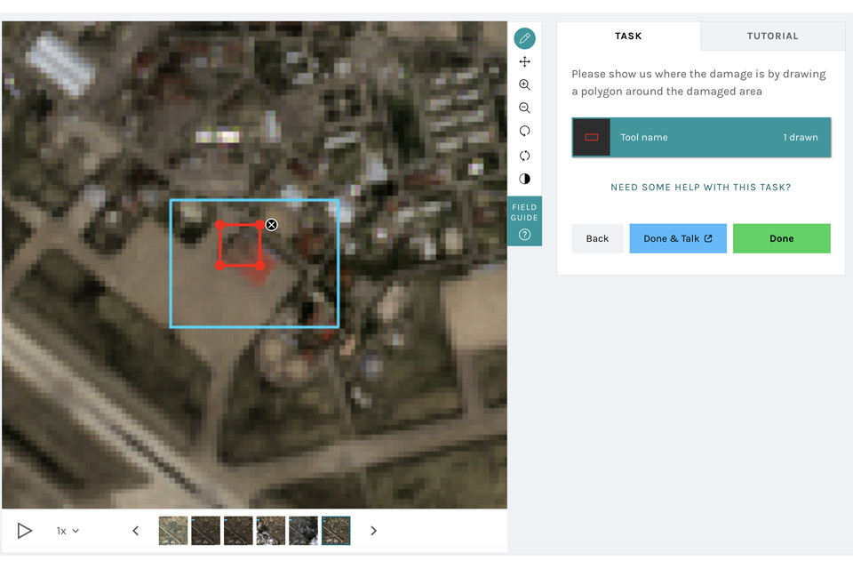
WISEN WATCH introduces a citizen science verification stage to this process. Participants examine optical satellite imagery for locations initially flagged by the radar analysis and assess whether visible signs of damage are present. Volunteers may identify collapsed buildings, burn scars, impact craters, or other indicators of destruction.
To support participants, the platform includes visual examples and guidance materials explaining what different forms of damage can look like in satellite imagery. These resources are designed to help volunteers build confidence and consistency in their assessments, regardless of previous experience.
Even a few minutes of participation can make a meaningful contribution. Every classification adds to a growing dataset that supports monitoring, research, and future environmental assessment.
WISEN WATCH was developed by Rebekah Harries and can be accessed via the Zooniverse platform. If you’d like to support our work, please consider donating here.